Hurricane coverage in this country points at the Atlantic by reflex. This year the Atlantic is the quiet ocean. NOAA’s outlook gives a 55 percent chance of a below normal Atlantic season, with 8 to 14 named storms, 3 to 6 hurricanes and 1 to 3 major hurricanes. Meanwhile the eastern Pacific has been busy, and the reason both things are happening is the same reason.
El Nino Is Running the Season
El Nino conditions warm the central and eastern tropical Pacific and change wind patterns across both basins at once. In the Atlantic it increases wind shear, which tears developing storms apart before they organize. In the eastern Pacific it does close to the opposite.
Warmer water and weaker shear on the Pacific side is a recipe for rapid development. So the same climate signal suppressing one basin is fueling the other, which is why a quiet Atlantic headline and an active Pacific headline can run on the same day without contradicting each other.
Genevieve Showed What That Looks Like
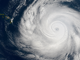
The eastern Pacific has already produced a storm worth studying. Genevieve intensified with startling speed, going from a tropical storm to a major hurricane in a matter of hours, and CNN’s climate desk reported it reached Category 5 strength before weakening.
By Sunday the National Hurricane Center had it down to 45 mph and moving west northwest as a weakening system. That whole arc, explosive intensification followed by a fast collapse, is characteristic of a basin with very warm water and very little shear.
Rapid Intensification Is the Real Threat
Storm counts are a bad way to measure danger. A season can produce eight named storms and still be catastrophic if one of them strengthens rapidly right before landfall, which is the scenario that leaves the least time for evacuation.
This is the part of hurricane behavior that has changed most noticeably. Warmer upper ocean water gives storms more fuel to convert quickly, and forecast lead times that were adequate for a slow strengthening system are uncomfortably short for one that jumps two categories overnight.
A Below Normal Forecast Is Not a Safe Forecast
Say this part clearly. Seasonal outlooks predict how many storms form, not where they go. Some of the worst hurricane disasters in American history occurred in seasons that finished at or below average activity.
Your personal risk is decided by one storm and one track, and no seasonal number has anything useful to say about that. Treat the outlook as information about insurance markets and emergency budgets, not about whether you should have a plan.
Peak Season Starts Now
August through October is when the overwhelming majority of Atlantic tropical activity happens, and the ramp is steep. Two quiet months mean nothing about what the next ten weeks will do.
Conditions also evolve. Shear patterns shift, dust from the Sahara that suppresses early season storms thins out, and water temperatures peak late in the summer. A basin can go from empty to crowded in about two weeks.
What the Pacific Side Means Inland
Eastern Pacific storms rarely make US landfall as hurricanes, but their moisture does arrive. Decaying systems tracking toward Baja California regularly push tropical moisture into the Southwest, and that is a flash flooding story in places with no drainage designed for it.
If you live in Arizona, Nevada, New Mexico or southern California, an active Pacific season is your business even though the storm names never appear in your local forecast. Desert flooding does not need a hurricane. It needs one afternoon of tropical rain on baked ground.
The Heat Is the Other Half of the Story
Long range guidance from NOAA has called for above normal temperatures across much of the country through mid August, extending a summer that has been defined more by heat than by storms.
That combination, a quiet ocean and a relentless heat dome, has shaped the whole season, which we covered when the Atlantic went eerily quiet while half the country baked. Heat is the deadlier hazard by a wide margin and it gets a fraction of the coverage a Category 3 gets.
What I Would Actually Do This Week
Check your insurance now, specifically whether you carry flood coverage, because standard homeowners policies do not include it and new policies typically carry a 30 day waiting period. Buying in September is often buying too late.
Then do the boring things. Photograph your home’s contents, know your evacuation zone by number, keep a week of medication ahead, and have a way to charge a phone without the grid. None of that depends on the forecast being right, which is the entire point.
Frequently Asked Questions
What is NOAA’s 2026 Atlantic hurricane forecast?
NOAA’s outlook gives a 55 percent chance of a below normal season, calling for 8 to 14 named storms, 3 to 6 hurricanes and 1 to 3 major hurricanes.
Why is the Atlantic quiet while the Pacific is active?
El Nino conditions increase wind shear over the Atlantic, which disrupts developing storms, while warming the eastern Pacific and reducing shear there. One climate signal suppresses one basin and boosts the other.
Does a below normal season mean I am safe?
No. Seasonal outlooks forecast how many storms form, not where they go. Severe hurricane disasters have happened in below average seasons, because your risk depends on a single track.
When is peak hurricane season?
August through October, with the sharpest ramp beginning in mid August. Quiet early months carry almost no predictive value for the remainder of the season.
Can Pacific hurricanes affect the United States?
Their moisture can. Systems weakening near Baja California often push tropical moisture into the Southwest, producing flash flooding in areas with little drainage capacity even without a landfalling hurricane.
What should I do to prepare right now?
Review flood insurance, since standard homeowners policies exclude it and new policies usually have a 30 day waiting period. Then document your belongings, learn your evacuation zone, stock medication and arrange off grid phone charging.