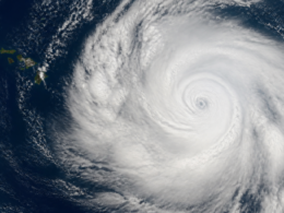
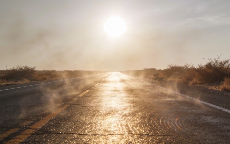
There is something genuinely strange about this summer. Extreme heat warnings and advisories have been covering millions of people, the Florida Panhandle and peninsula have been baking, and forecasters have been talking about heat index values above 105 for days on end. Meanwhile the 2026 Atlantic hurricane season has produced almost nothing. The National Hurricane Center’s tropical outlook for the North Atlantic, Caribbean and Gulf has been about as boring as that document ever gets, saying tropical cyclone formation is not expected over the following seven days.
Just how quiet the basin has been
By the measure meteorologists actually trust, which is accumulated cyclone energy rather than a raw count of names, the season has barely started. One tracking analysis put the Atlantic at roughly 6.6 percent of its expected seasonal energy, with the continental United States and Florida shares similarly tiny. For context, the average date of the third named storm in the Atlantic is around August 3. Getting to the end of July with the basin this empty is not unheard of, but it is on the slow end.
The seasonal forecast agrees with the silence
This is not just a lull inside an otherwise busy year. Seasonal outlooks have been pointing at accumulated cyclone energy in the range of 75 to 85, which is well below normal, with something like one to three major hurricanes and two as the likeliest number. When both the observed activity and the seasonal projection say quiet, that is a meaningful signal rather than a temporary quirk of the calendar.
The heat and the quiet share a cause
Here is the part that feels counterintuitive. A hot summer does not automatically mean a busy hurricane season, and this year is a clean demonstration of why. Sprawling upper level high pressure, the pattern forecasters have been describing as a ring of fire, does two jobs at once. It compresses and heats the air beneath it, which is what has been driving triple digit readings and oppressive heat index numbers. And it produces the sinking air and hostile wind shear that stops tropical systems from organizing. The same lid that is cooking the land is smothering the ocean’s storms.
El Nino is doing the heavy lifting
Layered on top of that is an El Nino that has been strong enough for scientists to publicly describe it as mind blowing, and it is the reason 2026 is being discussed as a candidate for the warmest year on record. El Nino reliably raises global temperatures and just as reliably suppresses Atlantic hurricane activity by increasing shear across the basin. If you wanted a single explanation for a summer of brutal heat and an empty tropical map, this is it.
Warm water is necessary but not sufficient
You will see plenty of commentary noting that Atlantic sea surface temperatures are running warm, and that is true. Hurricane season broadly tracks water temperatures reaching around 80 degrees. But warm water is only the fuel. A storm still needs low shear, moist mid levels and a trigger to organize around. Handing a system abundant fuel in an atmosphere that keeps tearing it apart produces a lot of disorganized cloud clusters and no hurricanes. This year has been a long lesson in that distinction.
Do not treat a slow July as a finished season
The genuinely dangerous conclusion to draw from all this is that the season is over. It is not. Atlantic activity historically concentrates from mid August through October, and the climatological peak sits in early to mid September. Seasons that start slowly have gone on to produce devastating single storms, and a below normal year that delivers one landfall in the wrong place is a catastrophe for the people under it. Seasonal totals are a planning tool, not a personal forecast.
The heat is the actual present danger
While everyone watches an empty tropical map, the thing currently harming people is temperature. Extended heat, with forecast patterns pointing to prolonged hot stretches into August, is a slower and less photogenic hazard than a hurricane and kills more Americans in a typical year. Schools have been letting out early because of it. That deserves at least as much attention as the storm that has not formed, and it responds to boring interventions like shade, hydration, cooling centers and checking on neighbors who live alone.
What to watch as August arrives
Two things. Watch whether the upper level ridge breaks down, because when that lid lifts, the same warm water that has been sitting there unused becomes available very quickly. And watch the shear forecasts across the main development region rather than the temperature maps, since shear is the variable actually holding this season back. If the ridge relaxes and shear drops while the water stays warm, a quiet July can turn into an unpleasant September in about ten days.
Frequently asked questions
Why is the 2026 Atlantic hurricane season so quiet?
A strong El Nino plus persistent upper level high pressure has increased wind shear and sinking air across the basin, which prevents tropical systems from organizing even over warm water.
Does a hot summer mean more hurricanes?
No. The same expansive high pressure that produces extreme land heat also suppresses tropical development, which is exactly what has happened this year.
When does the Atlantic season normally peak?
Activity concentrates from mid August through October, with the climatological peak in early to mid September, so late July says relatively little about the full season.
What is accumulated cyclone energy?
It is a measure combining storm intensity and duration, which makes it a better gauge of a season’s real activity than simply counting named storms.
Is a below normal season safe?
Not necessarily. Seasonal totals describe basin activity, not your risk. One landfall in a below normal year can still be devastating locally.
What should I actually be preparing for right now?
Heat. Prolonged extreme temperatures are the immediate hazard, and they respond to shade, hydration, cooling centers and checking on isolated neighbors.
The immediate consequence of a summer built like this is not a hurricane. It is what is burning in the West right now, and the scale of the Oregon fires is the clearest illustration available.