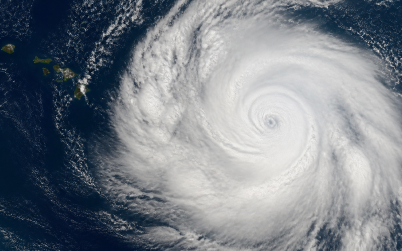
Forecasters are tracking Tropical Depression Two C in the Central Pacific, and the early guidance points the system in the general direction of the Hawaiian Islands. It arrives on the heels of Lala, which means the state is looking at a second system in a short window and at the cumulative effects that come with back to back weather rather than a single event.
A tropical depression is the weakest classification on the tropical cyclone scale, carrying maximum sustained winds below 39 miles per hour. That label describes wind, and wind is frequently not the thing that causes the damage.
What Two C Is Right Now
The C in the name marks the Central Pacific basin, the region monitored by the Central Pacific Hurricane Center rather than the Atlantic or Eastern Pacific offices. Systems there are numbered sequentially, and Two C is the second of the current season in that basin.
If the system strengthens past 39 mile per hour sustained winds it becomes a tropical storm and receives a name from the Central Pacific list. Crossing 74 miles per hour would make it a hurricane. Neither step is guaranteed, and depressions dissipate as often as they intensify.
Why Hawaii Is a Difficult Forecast
The islands sit in a stretch of ocean where several factors tend to work against approaching cyclones. Cooler water to the northeast removes the heat that fuels intensification, and wind shear across the region frequently tears storm structure apart before it can organize.
That history produces a dangerous complacency. Systems have weakened dramatically on approach many times, which trains residents to expect the same outcome. The storms that broke that pattern did serious damage precisely because the expectation ran the other way.
What Following Lala Changes
Back to back systems interact with the ground rather than with each other. Soil that absorbed significant rain from the first storm has far less capacity for the second, which means the same rainfall total produces more runoff, more flash flooding, and more slope failure.
The same compounding applies to infrastructure and to crews. Drainage already carrying load backs up faster, trees loosened by the first round come down more easily in the second, and utility teams still working restoration from one event start the next one already stretched.
Rain Is the Threat That Matters
In Hawaii the primary hazard from a tropical system is almost always water rather than wind. The islands are steep and volcanic, which means rainfall does not spread out. It funnels into narrow valleys and moves downhill at speed, turning ordinarily dry streambeds into serious hazards within minutes.
Flash flooding in that terrain gives very little warning. A stream can rise dramatically from rain falling miles upslope while conditions at the bottom of the valley still look manageable, which is why local guidance emphasizes never attempting to cross moving water on foot or by vehicle.
Travel and Flight Disruption
Hawaii travel is unusually sensitive to disruption because the alternatives are limited. There is no rerouting by road, interisland capacity fills immediately, and a single day of cancellations can cascade for the rest of the week as displaced passengers absorb every available seat.
Anyone with tickets should confirm the carrier’s weather waiver policy early rather than waiting for a cancellation notice. Airline scheduling has been under strain for other reasons this year as well, a dynamic our reporting on the Delta pilot scheduling impasse examined in detail, and weather stacked on top of an already tight network recovers more slowly.
What Residents Should Do Now
Standard preparation applies. Two weeks of water and shelf stable food is the long standing recommendation for island residents given supply chain isolation, along with charged devices, batteries, medications, and important documents in a waterproof container.
Yard preparation deserves attention as well. Loose outdoor items become projectiles in tropical storm winds, and clearing gutters and drains ahead of heavy rain does more practical good than almost anything else on a preparation list.
Where to Get Reliable Updates
The Central Pacific Hurricane Center is the authoritative source for track and intensity, and the local National Weather Service office issues the watches and warnings that actually govern local action. County emergency management agencies handle shelter and evacuation information.
Social media forecasts should be treated with real skepticism during tropical events. Single model runs showing dramatic outcomes circulate widely because they are alarming, and they routinely bear no resemblance to the official forecast, which blends many models with human analysis.
What to Watch Over the Next Few Days
The variables that matter are intensity trend, track shift, and forward speed. A slower system delivers more rain over any given location even at identical strength, which can make a weaker but slower storm the more damaging outcome.
Watches and warnings are the practical trigger. A watch means conditions are possible within roughly 48 hours and preparation should be finished. A warning means conditions are expected within about 36 hours and outdoor preparation should already be done.
Frequently Asked Questions
Will Tropical Depression Two C hit Hawaii?
Early guidance points the system toward the islands, but tropical forecasts shift considerably at multi day range. Follow the Central Pacific Hurricane Center rather than any single model image circulating online.
How strong is a tropical depression?
It carries maximum sustained winds below 39 miles per hour, the weakest tropical cyclone classification. Depressions can still produce heavy rain and dangerous flooding well out of proportion to their wind speed.
Why does a second storm matter more than the first?
Ground saturated by earlier rain absorbs far less, so identical rainfall produces more runoff, flash flooding, and landslide risk. Trees, drainage, and utility crews are all already stressed from the previous system.
What is the biggest danger in Hawaii?
Water. Steep volcanic terrain funnels rainfall into narrow valleys, producing flash flooding and landslides that develop with very little warning even when winds stay modest.
Should I change travel plans?
Check your airline’s weather waiver policy early. Hawaii has no alternate ground routing, so cancellations cascade for days as displaced passengers absorb the limited seats available.
What supplies should residents have?
Officials recommend island residents keep two weeks of water and shelf stable food, plus batteries, charged devices, medications, and documents protected from water.