Tropical Depression Two C strengthened into Tropical Storm Moke on Friday and is continuing toward Hawaii, and the National Weather Service has issued a flood watch for the Big Island. It arrives on ground that has not finished draining from Tropical Storm Lala a week ago.
That timing is the whole story. Moke is not a powerful storm by wind measurement. It is arriving somewhere that already absorbed a significant rain event, and saturated ground is what turns a modest storm into a damaging one.
What Changed From Two C to Moke
Crossing 39 miles per hour in maximum sustained winds is what moves a tropical depression to a tropical storm and earns it a name from the Central Pacific list. Moke is that upgrade.
The category change is administrative more than practical for people on the ground. What matters locally is rainfall totals, forward speed and where the heaviest bands set up, and none of those are captured by the name.
The Flood Watch and What It Means
A flood watch means conditions are favorable for flooding, not that flooding is occurring. It is the National Weather Service telling people to prepare and pay attention rather than to act immediately.
The escalation to watch for is a flood warning, which means flooding is happening or imminent. In steep terrain that transition can happen within minutes, which is why the watch stage is when preparation should actually get done.
Why Saturated Ground Changes Everything
Soil has a finite capacity to absorb water. Ground that took heavy rain from Lala has used a substantial share of that capacity and has not had time to recover, so the same rainfall total produces far more runoff.
The consequences compound in three directions. Streams rise faster because more water reaches them. Slopes fail more easily because saturated soil is heavier and less stable. And drainage systems that were already moving water back up sooner.
The Big Island’s Specific Vulnerability
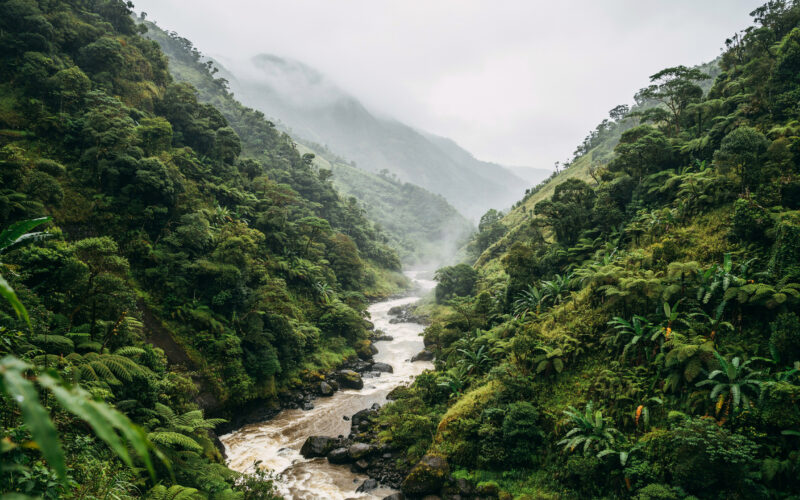
The terrain is steep and volcanic, which means rainfall does not spread out. It funnels into narrow valleys and gulches and moves downhill fast, turning normally dry channels into serious hazards with very little warning.
The dangerous part is that conditions at the bottom of a valley can look manageable while heavy rain falls miles upslope. A stream can rise dramatically from water nobody standing next to it ever saw fall, which is why the standing advice is never to cross moving water on foot or by vehicle.
What Officials Are Saying
The message from local officials has been to take this storm seriously specifically because of what came before it. That framing is deliberate, because a modest tropical storm following a bigger one tends to get dismissed by residents who just came through the larger event.
That instinct is backwards in this case. The second storm is more dangerous than its wind speed suggests precisely because the first one already used up the ground’s margin. The full picture of what a system like this does to the islands is in our earlier coverage of Tropical Depression Two C.
What Residents Should Do
Clear gutters and drains, secure loose outdoor items, and move vehicles off low ground. Those three things do more practical good in the hours before a rain event than almost anything else available.
Beyond that, standard island preparation applies. Officials have long recommended Hawaii residents keep two weeks of water and shelf stable food given supply chain isolation, along with charged devices, batteries, medications and documents protected from water.
Travel Impact
Hawaii travel absorbs disruption badly because the alternatives are limited. There is no rerouting by road, interisland capacity fills immediately, and a single day of cancellations can cascade through the following week.
Anyone with tickets should check their carrier’s weather waiver policy now rather than after a cancellation notice. Waivers frequently open before disruptions begin and give more flexibility to travelers who move early.
What to Watch This Weekend
The variables that matter are rainfall totals, forward speed and track. A slower storm delivers more rain over any given point at identical intensity, which can make a weaker but slower system the more damaging one.
Follow the Central Pacific Hurricane Center and the local National Weather Service office rather than model images circulating on social platforms. Single model runs showing dramatic outcomes spread widely because they are alarming and routinely bear no resemblance to the official forecast.
One practical note about how these storms get discussed locally. Hawaii residents have watched a long run of systems weaken dramatically on approach, and that history produces a reasonable but dangerous instinct to assume the next one will do the same.
The statistical basis for that instinct is real. Cooler water to the northeast and persistent wind shear across the region do tear up approaching cyclones frequently. But the storms that broke the pattern did serious damage specifically because the expectation ran the other way and preparation lagged.
The other thing worth flagging is how quickly conditions can change relative to how slowly official products update. Watches and warnings are issued on a schedule, while a gulch fills on its own timeline. If water is rising where you are, that observation outranks whatever the most recent advisory said.
Frequently Asked Questions
What is Tropical Storm Moke?
The system previously designated Tropical Depression Two C, upgraded to a named tropical storm on Friday, August 21 as sustained winds crossed 39 miles per hour. It continues toward Hawaii.
Is there a warning in effect?
A flood watch has been issued for the Big Island. A watch means conditions are favorable for flooding. A warning, which means flooding is occurring or imminent, is the next escalation.
Why is this storm dangerous if it is weak?
Ground saturated by Tropical Storm Lala a week earlier has far less absorption capacity, so the same rainfall produces more runoff, faster stream rises and higher landslide risk.
What is the main hazard?
Water, not wind. Steep volcanic terrain funnels rain into narrow valleys and gulches, producing flash flooding and slope failures that develop with very little warning.
Should I change travel plans?
Check your airline’s weather waiver policy now. Hawaii has no ground rerouting option, so cancellations cascade for days as displaced passengers absorb limited seats.
Where should I get updates?
The Central Pacific Hurricane Center for track and intensity, the local National Weather Service office for watches and warnings, and county emergency management for shelter information.