Weather apps are handy, but they only tell you someone else’s conclusion. Learning to read the radar yourself puts real power in your hands. Suddenly you can see the storm coming, judge whether that dark cloud will pass you by, and decide when it is safe to walk the dog or fire up the grill. It is easier than it looks, and once it clicks, you will find yourself checking the radar the way sailors read the sky.
What the Colors Mean
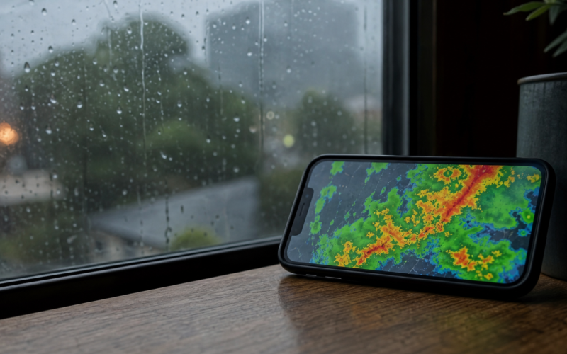
Radar images use color to show how heavy the precipitation is. Greens are light rain, yellows and oranges are moderate to heavy, and reds signal intense downpours or storms. Some maps add purples and whites for hail or extreme conditions. Once you learn this simple scale, a glance at the map tells you not just where rain is, but how serious it is. That single skill instantly makes the radar far more useful.
Watch the Motion, Not the Snapshot
A still radar image is only half the story. The real magic is the loop, the short animation that shows how the weather is moving. By watching the direction and speed of the blobs of color, you can estimate when a storm will reach you and how long it will last. Always press play on the animation rather than trusting a single frame. Motion is what turns a static picture into an actual short term forecast you make yourself.
Judge Timing and Direction
With the loop playing, find your location on the map and trace the path of the incoming weather. If a band of green is drifting steadily toward you, you can roughly judge how many minutes until it arrives based on how fast it moved across previous frames. This lets you answer the everyday questions that matter: do I have time for a quick errand, and should I bring the laundry in now or in an hour.
Know the Radar’s Limits
Radar is powerful but not perfect. It can occasionally show returns that are not really rain, and it does not capture everything happening at ground level, especially far from the radar station. Fast changing summer storms can also form and shift quicker than a loop suggests. Treat the radar as an excellent guide rather than gospel, and combine it with a look out the window and official alerts for anything potentially dangerous.
Frequently Asked Questions
What do the radar colors mean? They show precipitation intensity. Green is light rain, yellow and orange are heavier, and red marks intense storms. Purple or white often indicates hail or extreme weather.
Why should I watch the loop instead of a single image? The animation shows direction and speed, which is how you estimate when weather will reach you. A still frame cannot tell you whether a storm is coming or going.
How do I estimate when rain will arrive? Find your spot on the map and watch how fast the color band moved across earlier frames, then project that speed forward to your location for a rough timing estimate.
Can the radar be wrong? Sometimes. It can show false returns and miss ground level details, and fast storms can outpace it. Use it as a strong guide alongside a look outside and official alerts.
Do I need a special app to see radar? No. Many free weather sites and apps include an interactive radar with a loop feature. Any of them will let you practice these skills without extra cost.
Related reading: For more on this, take a look at our guide to what a TV weather forecast actually tells you.
The Bottom Line
Reading the radar is a small skill with an outsized payoff. Learn the colors, watch the loop, judge the motion, and respect its limits, and you can answer your own weather questions in seconds. Instead of waiting for someone to tell you what the sky is doing, you will simply know. It is a genuinely satisfying bit of everyday expertise, and it might just save your picnic.